The SAR team responded to a call on July 27, when two overdue climbers were reported missing. The two Santa Monica residents, Jan Szupinski and Stephen Kania, left at 6 a.m. to climb the northeast gully of Laurel Mountain (see route information below) and were to return before nightfall. When they failed to return by midnight, their wives called 911.
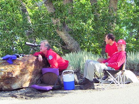
36x Scope Setup - Laurel Mtn Rescue - July 28, 2003
A sheriff deputy located their vehicle parked at the Convict Lake trailhead parking lot. Attempts by SAR team members Bill Greene, Jutta Schmidt, Greg Enright and Jeff Holmquist were made to contact the subjects from both the outlet to the lake and at the base of the climb. But, there was no response.
Greg and Jeff were assigned to climb to the top of Laurel Mountain (via the easier Laurel Creek route, and got there before sunrise) to see if the climbers had signed the summit register. Again, no evidence showed that they had reached the top.
The next morning, July 28, at 6 a.m., SAR team members went to Mammoth Airport to await the arrival of the California Highway Patrol helicopter, H40. Prior to the arrival, SAR members located the missing climbers on the mountain at about 9,300 feet, via a spotting scope.
Brian Brenninkmeyer, was sent to the east side of Convict Lake with a 36 power spotting scope. With that and his 20/15 vision, he actually saw the victims on that huge mountain. That amazed everybody - especially Brian. That was the first time we ever got any results with that technique.
The CHP helicopter was directed to their location, and it appeared to them that the men were not injured. However, they were stranded. The CHP helicopter had to leave for Fresno, due to maintenance issues.
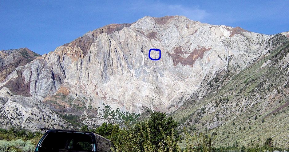
Blue circle marks victim's location on Laurel Mountain as seen from Convict Lake
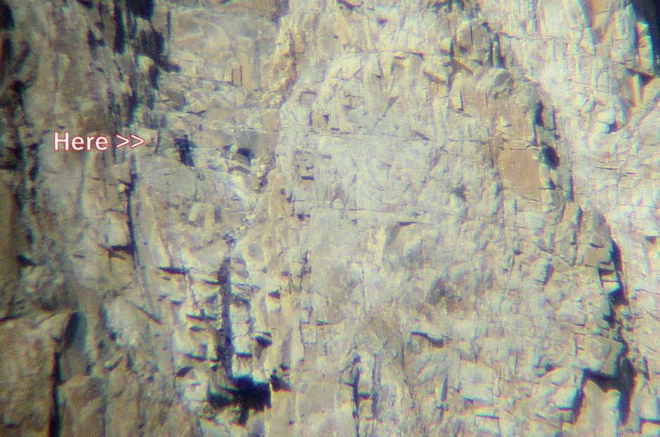
36x Scope photo from Convict Lake. The subjects were in a pretty bad spot, 60 degree steep slabs. Brian saw them try to go up, but they got only ten feet before giving up. Access looked very hard and very unsafe, with steep and loose stuff above, rotten cliffs below. One observer called it boulders in powdered graham crackers.
A Blackhawk helicopter was then requested from the Office of Emergency Services, and a Spartan 452 (Army Reserve) arrived on the scene at about 11 a.m. With the assistance of the SAR team, the emergency crew was able to locate the subjects, and extract them.
Both men were brought to Mammoth Airport in good condition, despite their overnight stay on the side of a cliff. The climbers became stranded due to the bad weather, poor route-finding skills, and the fact that their climbing rope was partially cut (in the middle of the rope) by falling rock.
Various rescue plans were considered and all were dangerous. Fortunately the Blackhawk crew was able to hoist the victims to safety on two trips. First they offloaded everything they could at the airport to lighten the load.
Before long they came back with one of the victims. Their power control goes from 0 to 250. They needed all 250 to do the hover with the rotors ten feet from the rock.
The rescue crew member did not go down on the winch line as is the usual case - too dangerous here. He lowered the jungle penetrator on the winch line, and hoped the victims would figure out how to get on it. They both had their climbing harnesses on, so managed to clip in and get hauled away from the rock, then winched up. Quite an airy ride.
Second flight got the remaining victim. The helo crew did a wonderful job - with a 20 year old aircraft. They are all civilian reserves, but 3 of them work on the base. The pilot's job is head of helo maintenance and test pilot. We got the right guy for this job!
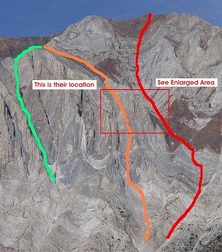
The RED route is identified as the Northeast Gully on the SuperTopo.Com website.
GREEN is the route the victims thought they would descend.
ORANGE is the route the victims thought they were ascending.
If the team had attempted to reach them from the top ridge the terrain appeared to be Class 3-4 turning possibly into low 5 near their location. Below their location was mid to high class 5. The quality of the rocks however is not great for anchoring. The Blackhawk helicopter was far faster in getting them out anyway.
Click Here For More Pictures
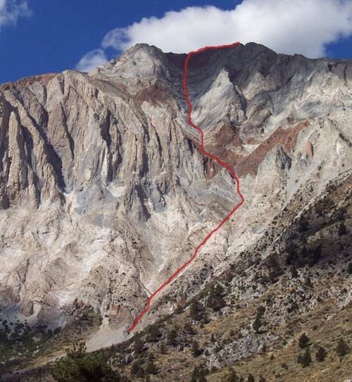
© Chris McNamara
The Northeast Gully route on Laurel Mountain is described on the SuperTopo.Com website ...
"This is a true 'adventure climb' that derives its pleasure less from the technical difficulties and more from the unique rock, tricky route finding, and sheer size of the mountain."
"This route is huge and involves over a mile of 3rd and 4th class climbing."
"From a distance, the line is clear. Once on the climb, however, you enter a maze of gullies and it is easy to get lost."
"Think of this route as part Sierra scramble and part canyoneering expedition."
"The rock in the main gully is mostly a pumice stone-like substrate that offers a clean and enjoyable passage through the surrounding sea of decaying loose choss."
"Along the way, various types of red, white, gray, and black rock enter the gully making this a geologist’s dream climb."
"The first ascent of this route marked the first time a belay was used in the High Sierra."