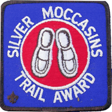
Silver Moccasins Trail Award patch
While I was in the Navy, on August 13-18, 1956 I went with a Boy Scout group from Los Angeles, California let by Jim Goldstein on the 53 mile Silver Moccasins Trail.
The Silver Moccasin Trail is one of several hiking award trails offered by the Los Angeles Council, Boy Scouts of America. The route varies from time to time as new roads are built; forest fires destroy areas, etc.
The trail starts on the fringes of the large Los Angeles metropolitan basin and proceeds to the ridge of the San Gabriel Mountains which it follows East. It ends shortly after the climb of Mt. Baden-Powell, named in honor of the founder of Scouting.
Most of the route is heavily developed and offers little real wilderness. One of the prettiest campsites was Little Jimmy Springs.
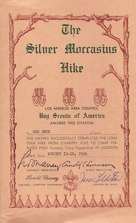
I earned The Silver Moccasins Hike Award in 1956
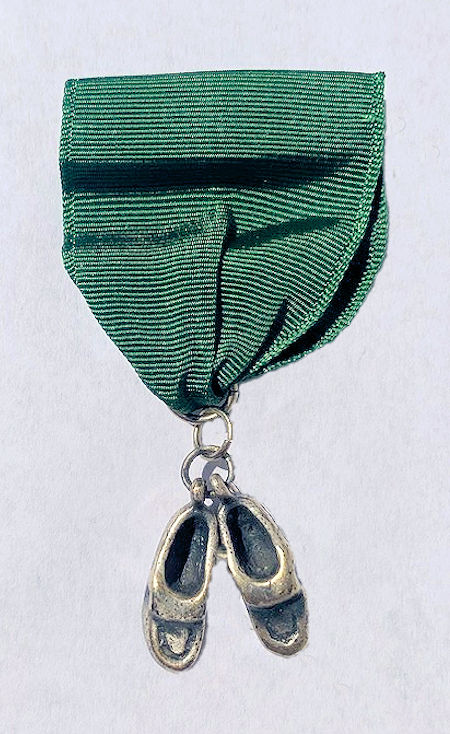
I earned The Silver Moccasins Hike Award in 1956
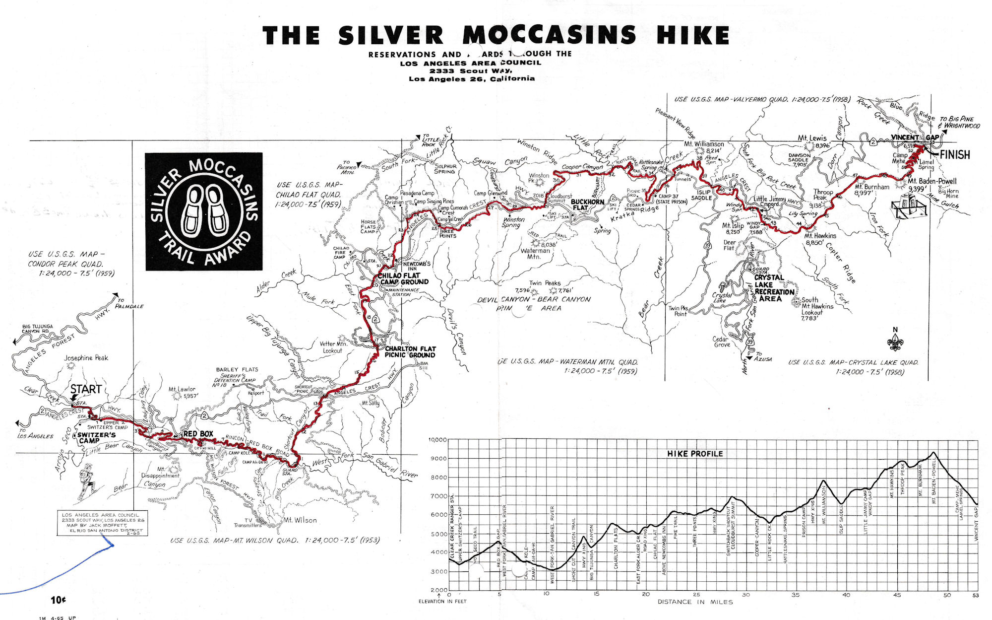
The Silver Moccasin Trail is a 53-mile trail located in the San Gabriel Mountains, northeast of Los Angeles. It begins at Chantry Flat Recreation Area above the city of Arcadia, California, traversing upward and down through several canyons and along the high ridges of the Angeles National Forest.
This trail connects Mt. Baden-Powell, Mount Burnham, Throop Peak and Mount Hawkins. It comes to its highest point of 9,399 feet at Mount Baden-Powell after which point it descends to its terminus at Vincent Gap on the Angeles Crest Highway near Wrightwood.
This Trail Route Map is from a brochure dated 1965.
The landscape of the Silver Moccasins Trail varies from lowland chaparral slopes, to oak-lined canyons, to the fir and pine forests of Mt. Baden-Powell, where several Southern California councils of the Boy Scouts of America have placed a monument to their founder, Lord Robert Baden-Powell.
The Silver Moccasins Trail started as a series of Indian trails originally created by the local Native Americans (probably Tongva), but its use was continued by Anglo settlers who either hunted or hiked along its route.
In 1942, the Los Angeles Area Council of Boy Scouts established a designated route as the Silver Moccasins Trail, and any Scouts who complete the hike, usually involving several days travel, are qualified to receive the Silver Moccasins Award. Boy Scouts, especially those who are enrolled in "hiking troops," walk this trail usually as part of a five-day backpack trip.
The LA Area Council, BSA map that was printed before 1953 (has the name "Flores" in the corner) showed a 60 mile route. It started at the end of the Pacific Electric rail line at Grand View Avenue (6 miles from Chantry Flat). The trail ended at Camp Pepperdine (elevation 6150 ft elevation) near Jackson Lake.
The map identifies the six 7.5 minute USGS (1953-1959) topographic maps for the trail (Condor Peak, Chilao Flat, Mt. Wilson, Waterman Mtn, Crystal Lake, and Vaeyermo Quadrangles). The map showed the Mt Baden Powell summit as a short side trip off the main trail.
Alternate starting points, or trailheads, have been established for the SMT more than likely due to overuse or overcrowding at Chantry Flat, which has somewhat reduced the adventuresome attractiveness of the younger, less-traveled version.
However, sections of the trail which are only 8 miles to 10 miles in length while reaching the Baden-Powell summit qualify it as a 20-mile (flatland) hike due to gains in elevation which are about 5,000 feet. The Baden-Powell portions of the hike are also beneficial for acclimation to altitudes for beginning hikers who may experience mild altitude sickness between 8,000 feet and 9,000 feet.
Recommended Itinerary
FIRST DAY:
Clear Creek Station. Hike down trail from parking lot on southeast side of intersection to Switzer's Forest Station. Follow trail upstream to road; from road to Red Box. File itinerary and get fire permit and information from Ranger. Stop for lunch and water. Follow West Fork Road to Valley Forge campground. Hiked 8.8 miles; elevation gain 1,370 feet; time 6 hours. (Alternate camp first night West Fork.)
SECOND DAY:
Break camp early. Follow road to West Fork Station; turn north on Short Cut Trail to Short Cut Saddle, (carry water from West Fork) cross Angeles Crest highway and follow trail to Big Tujunga Creek. Lunch and rest. Hike on to Charlton; follow trail to northwest section of Charlton (lower road near pump house.) Then trail down east fork of Alder Creek and up to Chilao; go into Lower Chilao (left turn off trail at second paved road.) Check in with Ranger. Make food pickup here. Hiked 13.0 miles; elevation gain 3,445 feet; time 10 hours.
THIRD DAY:
Lower Chilao rest day - make food pickup.
FORTH DAY:
Hike to Upper Chilao and follow Horse Flats - Pandido Trail north, then east to Three Points; carry water and eat lunch along trail. Cross Angeles Crest highway to east side and follow old forest service road to Squaw Summit; cross Angeles Crest highway to west side and continue along road on west side to near Panorama Point; cross high. way to east side and continue along trail to Cloudburst Summit; cross highway to the west and follow Cooper Canyon Road to campground. Hiked 10.5 miles; elevation gain 1,838 feet; time 7.5 hours; (purify or boil water at Cooper Canyon campground.)
FIFTH DAY:
Follow trail down Cooper Canyon to Little Rock creek; turn right and go up Little Rock creek; follow trail to Cedar Spring Saddle; cross highway and follow trail up Kratka Ridge just east of highway department garage; cross highway to north at Little Rock - Bear Creek Saddle and follow trail up west side of Mt. Williamson; lunch and rest; follow trail to Islip Saddle; MAKE FOOD PICKUP HERE: cross highway to south side and follow trail up west and north sides of Mt. Islip to Little Jimmy campground (spring is 1/4 mile east of campground). Hiked 10.1 miles; elevation gain 3,210 feet; time 8.75 hours.
SIXTH DAY:
Little Jimmy campground - rest day.
SEVENTH DAY:
Follow trail to the east; carry water from Little Jimmy; hike to Mt. Baden-Powell; sign register; eat lunch; hike to Lamel Spring; hike on to Vincent Saddle. Hiked 10.6 miles; elevation gain 1,959 feet; time 7.75 hours.
NOTE:
There are no overnight camping facilities at Vincent Saddle.
| RECOMMENDED TRAIL SCHEDULE | ELEVATION FEET |
HIKING HOURS TODAY |
MILES BETWEEN POINTS |
MILES TODAY |
MILES FROM START |
MILES FROM FINISH |
GRADE FT. PER MILE |
|---|---|---|---|---|---|---|---|
| FIRST DAY | |||||||
| Clear Creek Ranger Station | 3650 | 0.0 | 0.0 | 0.0 | 53.0 | -- | |
| Switzer's Forest Station | 3300 | 1.0 | 1.0 | 1.0 | 52.0 | -350 | |
| Red Box Ranger Station | 4620 | 3.8 | 4.8 | 4.8 | 48.2 | +1370 | |
| Valley Forge Group Camp | 3470 | 6.0 | 4.0 | 8.8 | 8.8 | 44.2 | -1200 |
| SECOND DAY | |||||||
| West Fork Campground | 3070 | 2.5 | 2.5 | 11.3 | 41.7 | -400 | |
| Highway Crossing | 4780 | 4.0 | 6.5 | 15.3 | 37.7 | +1710 | |
| Big Tujunga Canyon | 4250 | 1.0 | 7.5 | 16.3 | 36.7 | -530 | |
| Charlton Flat Picnic Grounds | 5625 | 2.5 | 10.0 | 18.8 | 34.2 | +1375 | |
| East Fork Alder Creek | 4960 | 1.5 | 11.5 | 20.3 | 32.7 | -650 | |
| Chilao Ridge | 5320 | 1.0 | 12.5 | 21.3 | 31.7 | +360 | |
| Lower Chilao | 5170 | 10.0 | 0.5 | 13.0 | 21.8 | 31.2 | -150 |
| THIRD DAY | |||||||
| Lower Chalao Rest Day | 0.0 | ||||||
| FOURTH DAY | |||||||
| Three Points | 5900 | 4.0 | 4.0 | 25.8 | 27.2 | +730 | |
| Cloud Burst Summit | 7018 | 4.7 | 8.7 | 30.5 | 22.5 | +1118 | |
| Cooper Canyon Campground | 6240 | 7.5 | 1.8 | 10.5 | 32.3 | 20.7 | +778 |
| FIFTH DAY | |||||||
| Little Rock Creek | 5600 | 1.5 | 1.5 | 33.8 | 19.2 | -640 | |
| Cedar Spring Saddle | 6640 | 2.9 | 4.4 | 36.7 | 13.3 | +1040 | |
| East Kratka Ridge | 6880 | - | - | - | - | +240 | |
| Little Rock-Bear Creek Saddle | 6720 | 0.7 | 5.1 | 37.4 | 15.6 | -160 | |
| Mt. Williamson | 7850 | 1.4 | 6.5 | 38.8 | 14.2 | +1130 | |
| Islip Saddle | 6680 | 1.3 | 7.8 | 40.1 | 12.9 | -1170 | |
| Little Jimmy Camp | 7480 | 8.75 | 2.3 | 10.1 | 42.4 | 10.6 | +800 |
| SIXTH DAY | |||||||
| Little Jimmy Camp Rest Day | 0.0 | ||||||
| SEVENTH DAY | |||||||
| Mt. Hawkins | 8760 | 2.6 | 2.6 | 45.0 | 8.0 | +1280 | |
| Throop Peak | 8960 | 0.8 | 3.4 | 45.8 | 7.2 | +200 | |
| Mt. Burnham | 8920 | 1.3 | 4.7 | 47.1 | 5.9 | -40 | |
| Mt. Baden-Powell | 8999 | 1.4 | 6.1 | 48.5 | 4.5 | +479 | |
| Vincent Saddle | 6590 | 7.75 | 4.5 | 10.6 | 53.0 | 0.0 | -2909 |
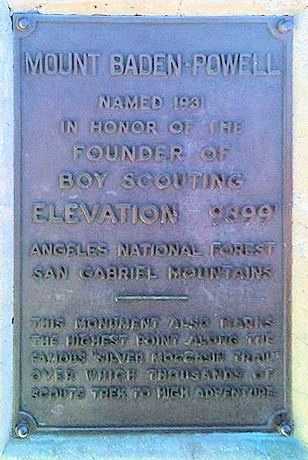
Mount Baden-Powell Identification Plaque on the Baden-Powell Monument
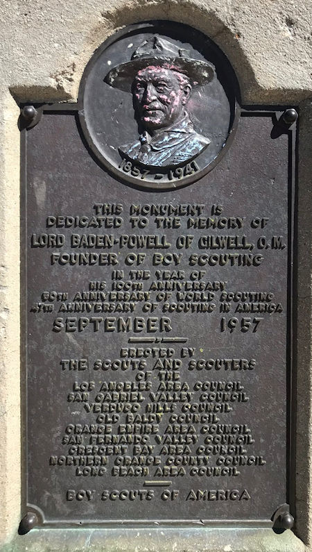
Baden Powell Monument Dedication Plaque